TRAINING TAILORED TO YOUR NEEDS
We offer geographic information systems, GeoAI, and aerial drone training for people of all levels. You can work with our friendly experts to develop highly sought-after skills in the field of spatial data science. The following trainings are available to support your digital transformation.
BASIC AND ADVANCED DRONE TRAINING
On-site or Online
DetailsBASIC AND ADVANCED GIS
On-site or Online
DetailsBASIC AND ADVANCED GeoAI
On-site
DetailsMEET UP AND FLY
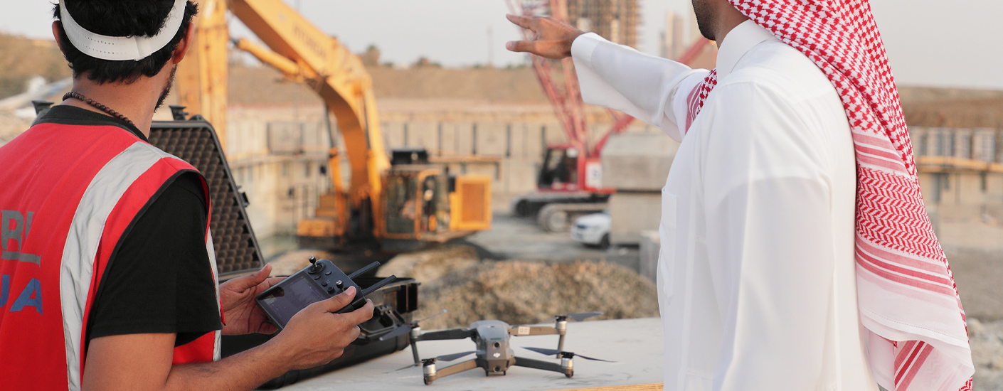
Our expert trainers use drones in industries ranging from real estate to construction & public safety. They go through a thorough vetting process and onboarding program before they begin training with us.

PERSONALIZE YOUR TRAINING
We will ask some preliminary questions before your training to ensure the session provides maximum results. Sessions can cover flight operations management, rules and regulations, DJI flight modes, and other advanced topics depending on your needs. We will provide all of the equipment you need on-site.
WHERE YOUR SKILLS TAKE FLIGHT
We offer personalized training sessions, no matter your location. With our courses, you enjoy the opportunity to work with professionals and learn at your own pace. GIS, geospatial artificial intelligence, and drone flying are all highly marketable skills, and our experts offer engaging sessions to help you master each.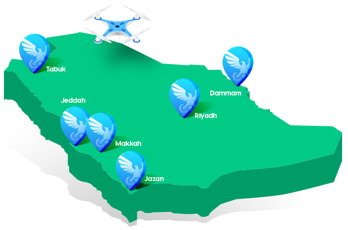

BROWSE TRAINING LOCATIONS
Our courses in Saudi Arabia are taught in Jeddah, Makkah, Riyadh, Tabuk, Dammam, and Jazan.
CONTACT US , If you don’t see your location
We are happy to see how we can work together.
BASIC AND ADVANCED DRONE COURSES
This course is for people who use UAVs for fun or work. Here are a few of the things you will learn in your session with us.
For the Basic course, you will learn :
- Hands-on flying time
- Handling obstacles
- Capturing photo and video
- Understanding best practices
- How to use drone applications
For the advanced course, you will learn :
- 2D\3D surveying of land, areas, cities
- Inspection and industry
- Cinematic flying
- Safety and security
- Maintenance
- Construction
Course Types :
- On-site
Course Price :
- 285 USD One person for two hours
- 470 USD Two people for two and a half hours
- 585 USD Three people for three hours
BASIC AND ADVANCED GIS
GIS is an advanced technology used to collect and analyze geospatial data and information. Drones play a crucial role in gathering data for GIS. Aljazeera Falcons can train students in both basic and advanced aspects of using UAVs for GIS.
For the Basic course, you will learn :
- Basics about GIS 1, 2, 3
- How to convert 2D/3D cloud points to map
- Converting soft and hard copy drawings to digital maps
- How to build a solid Geodatabase
- Analyzing and classifying layers
- Building geometry networks
Course Types :
- On-site
- Online
Course Price :
- 285 USD One person for two hours
- 470 USD Two people for two and a half hours
- 585 USD Three people for three hours

BASIC AND ADVANCED GeoAI
GeoAI is a cutting-edge technology that can help you with mapping, data acquisition, spatial analysis, geospatial modeling, and other applications. We offer courses from beginner to advanced levels to help you master the uses of drones for GIS mapping and many other applications.
For the Basic course, you will learn :
- How to collect the data from many cloud points or satellite images and convert it to useful information.
- How to do mathematical equations to correct data, or to find the best analysis and decisions.
- How to link the database and systems integration.
- How to build decision maker systems based on your needed information to manage work.
- The advantage of using VR and AR and how to build gamification systems to simplify work.
Course Types :
- On-site
- Online
Course Price :
- 285 USD One person for two hours
- 470 USD Two people for two and a half hours
- 585 USD Three people for three hours