CONVERTING PAPER DRAWINGS TO DIGITAL GIS DRAWINGS
Apply our various facility management solutions to improve your operations and experience a digital transformation of your own. We offer the following tools to support your business’s best property and facility management.
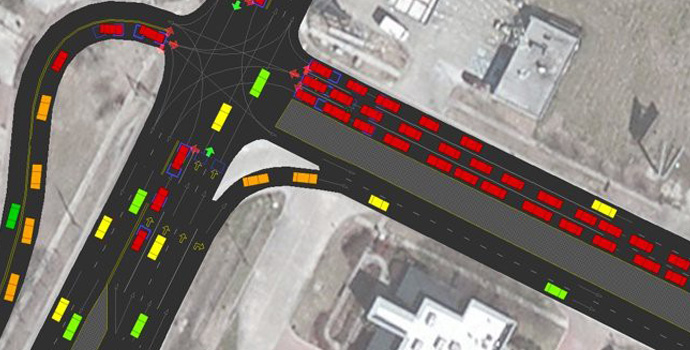
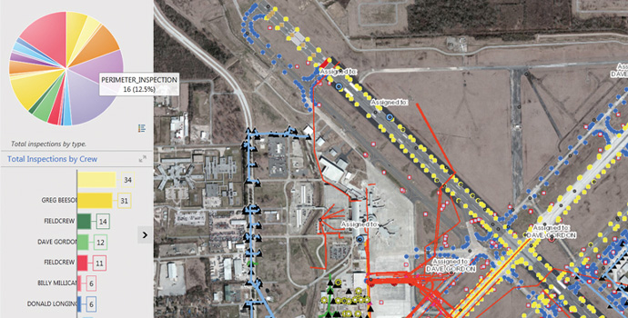
1. Infrastructure Management System
Our platform allows you to manage and extract key infrastructure data to inform better decision-making.
Our platform allows you to manage and extract key infrastructure data to inform platform allows you to manage and extract key infrastructure data to inform better decision-making.
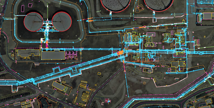
2. 3D Geographic Information System application
Utilize our cutting-edge 3D GIS technology to inspect and manage everything from transportation systems to underground utilities equipment and any related descriptive information.
Projects Our BIM application allows you to create smart 3D models to plan, construct, and realize your urban planning projects
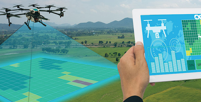
3. Aerospace: "GIS+" Applications
Build intelligent geospatial models for aerospace applications, using the latest technology and precise geographic data to plan, analyze, and make informed decisions at each phase.
This convenient platform helps you plan and manage infrastructure over a wide range of projects This convenient platform helps you plan and manage infrastructure over a wide range of projects.
4. Mobile Applications
Our intuitive mobile application allows you to store and access geospatial data and information easily for better facility management.
We help you process and analyze big data to improve your projects and make cities smarter We help you to improve your projects and make improve your projects and make cities smarter We help you to improve your projects and make cities smarter.
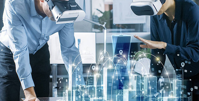
5. Virtual Reality
Use virtual reality tools to plan and model test facilities and analyze data to fuel better operations by providing real-world data under one roof.
Use this feature to process and monitor an area and its physical characteristics. platform helps you build a data engine for urban planning, using 2D and 3D urban planning, using.
6. Simulation
Create detailed simulations to assess test facilities, collect geospatial data and information, troubleshoot, and work toward a successful, tech-driven future.
Managers who utilize VR and AR can improve operational efficiency, accelerate training outcomes, and improve knowledge improve operational efficiency, accelerate training outcomes, and improve knowledge retention.