TRACK AND MANAGE VALUABLE GEOGRAPHIC DATA
Utilize geospatial artificial intelligence to track and identify objects, understand important geographic data, and gain valuable insights to support your operations. This tool can help businesses in various industries build smarter processes and adapt to the digital transformation.
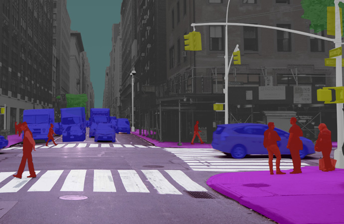
1. 3D Object Recognition
3D object recognition allows you to identify various categories and the objects within them. Gain advanced 3D insights, like the shape, volume, or position of an object and recreate geospatial models to advance your technology and automate processes across your business.
Manage and extract key infrastructure data to inform platform allows you to infrastructure data to inform better decision-making.
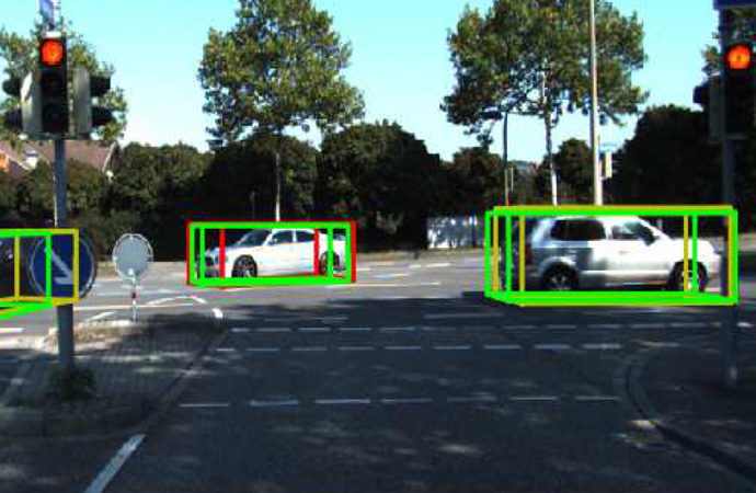
2. Object Detection
Use our recognition system to implement better object detection technology. This tool can help you power autonomous machines, capture key object data, and increase prediction accuracy.
Our system helps you build geospatial models and create a database of useful information so you can forecast, manageSystem to protect resources, predict disaster information, prevent disasters, and optimize identification time
3. Remote Sensing
Use our recognition system to assess and monitor physical characteristics of anything from land space to natural resource locations. This technology allows you to extract valuable data remotely to inform better decision-making.
Manage and extract key infrastructure data to inform platform allows you to infrastructure data to inform better decision-making.
Geospatial Artificial Intelligence
GeoAI is an emerging technology that helps both public and private sector businesses conduct better geographic data analysis. You can use geospatial artificial intelligence to do anything from identifying slums in cities to building extraction and object detection. 80% of the datasets that we generate today are geospatial, so this technology is pivotal for a whole variety of industries.